Heavy Rainfall Disaster in Eastern Japan Caused by Typhoon 0206 from July 9 to 12, 2002
Heavy Rainfall Disaster in Eastern Japan Caused by Typhoon 0206 from July 9 to 12, 2002
Motoyuki Ushiyama
The Typhoon 0206 (CHATAAN) attacked the Pacific coast of Japan from July 9 to 12, 2002. This typhoon caused heavy rainfall in eastern Japan. In Gifu Pref., hourly precipitation of 93mm was recorded on July 10 and the total precipitation amounted to more than 500 mm. The highest accumulated precipitation in approximately the last 20 years was recorded at several observatories in the Iwate Pref. This rainfall caused the deaths of 7 persons, the destruction of 39 houses, and the inundation of approximately 9,800 houses in Japan. The worst damage caused by this event occurred in Iwate Pref. in places such as Higashiyama town in which twenty-five percent of all houses were inundated. The residents of the town had several previous flood experiences. However, In spite of these experiences, extensive damage occurred because the water level rose faster than in past floods. In Ogaki city, Gifu Pref., the flooding of the Otani River caused the inundation of 550 houses. It was criticized that a fuse plug levee of the Otani River exists in the neighborhood of residence area. The real time rainfall information and hazard maps developed recently were not sufficiently utilized as indicated by the results of questionnaire regarding damaged municipalities.
Key words: heavy rainfall disaster, flood damage, disaster information, Iwate prefecture, Gifu prefecture
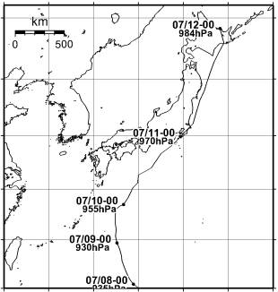
Fig. 1 The route of the typhoon 0206.
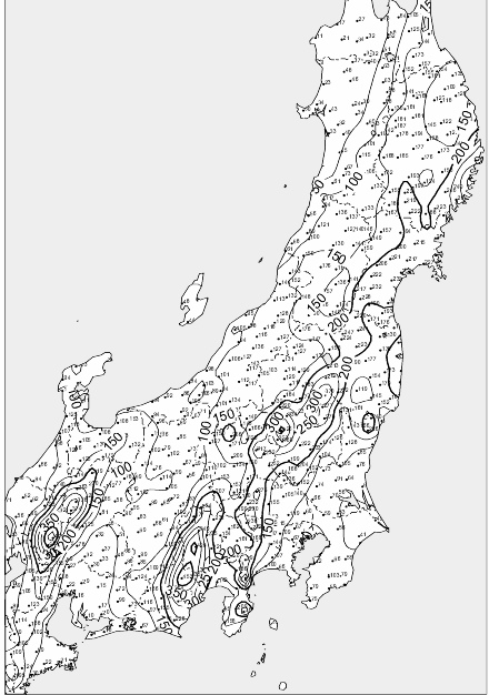
Fig. 3 48-hour precipitation distribution map (July 10 to 11).
| 24-hour precipitation | Soil water index |
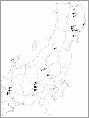 | 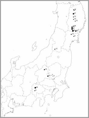 |
Fig. 5 Observatories with revised highest (1979 to 2000) precipitation.
Box mark size shows the difference between highest and present record.
Table 1 The damage in each prefectures
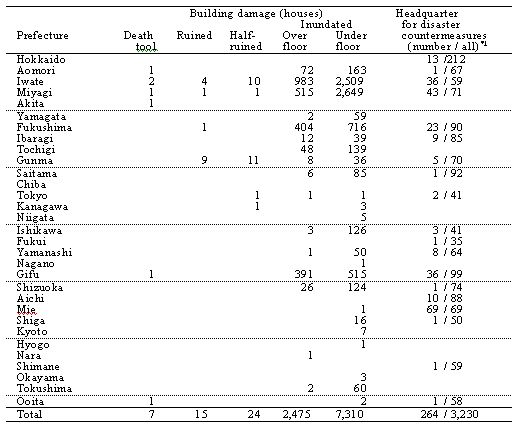
*1 The number of established municipal headquarters for disaster countermeasures / The number of all municipalities of the prefecture.
*2 Blank column show "0".
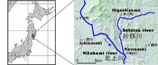
Fig. 6. Location of Higashiyama Town, Iwate Prefecture.
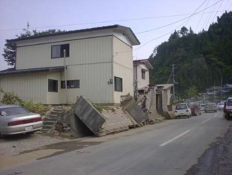
Photo 4. Inundated house in Higashiyama Town.
This house was inundated over-flower in spite of it was built on the fill ground (about 1m). The wall was destroyed river water. Photo 4, 5 and 6 were taken at July 13 by the author.
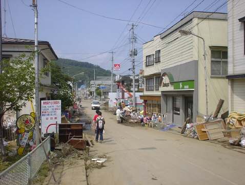
Photo 6. The central area of Higashiyama town.
This area was inundated over 1m. Ground was covered mud from river. Many disaster refuses were throwing to road.
M.Ushiyama Top Page:-> disaster-i.net
E-mail:-> Here


